Ishigaki Hikes & River Treks.
Our team’s recommendations, whether you’re looking for a short discovery trek or longer routes for passionate hikers.
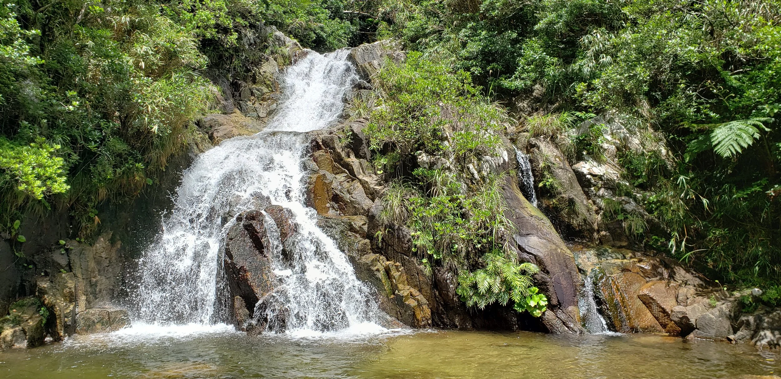
Arakawa Waterfall
Arakawa Waterfall is the place we visit on our Sky Adventure River Trekking Tour, but if you are confident hikers, you can also go on your own. Here is how.
We discourage families with children under 12, or anyone not used to wild environments, from doing this trek on their own.
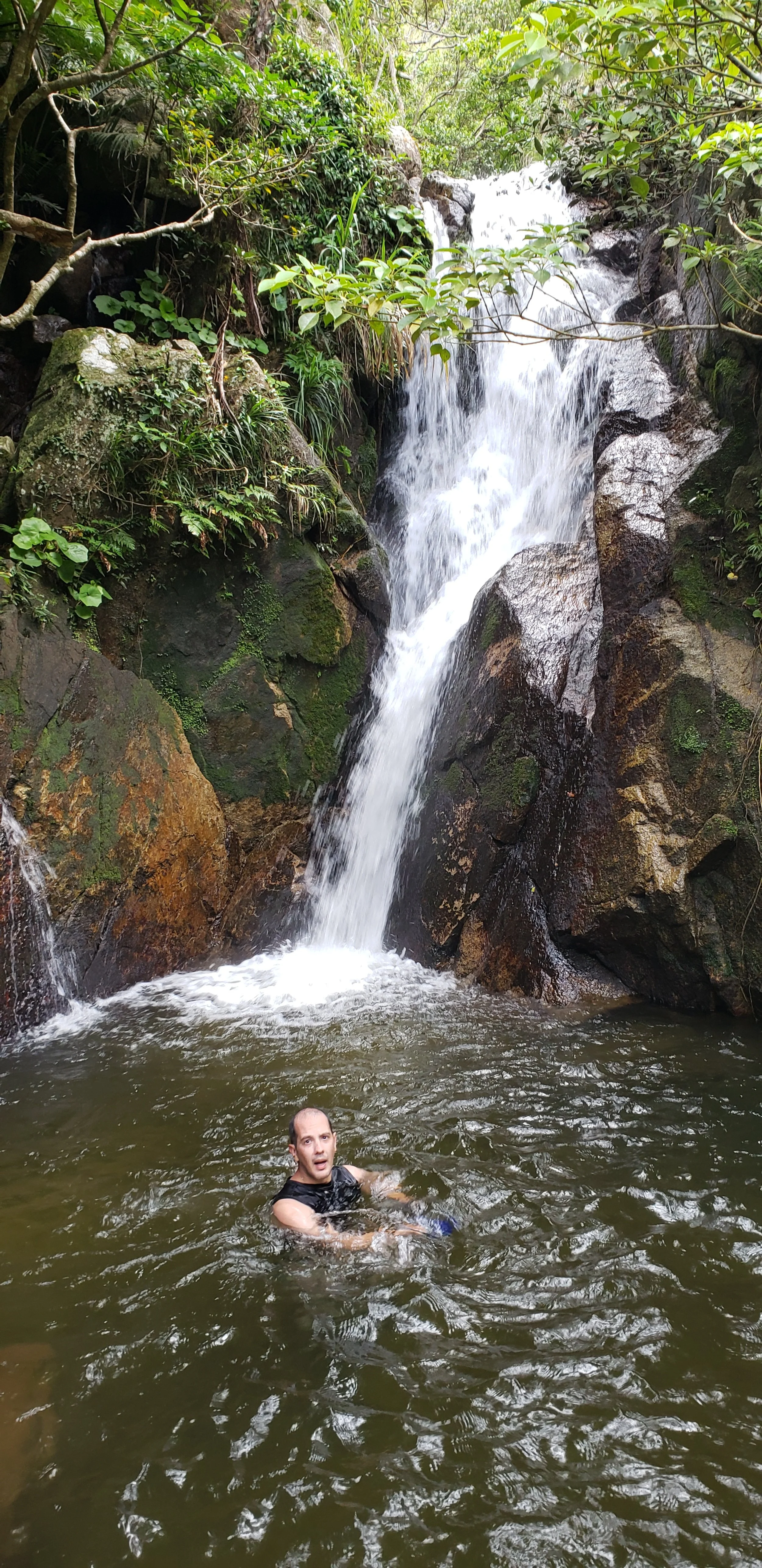
The site: Arakawa Waterfall begins with a small natural pool under the bridge, a very popular spot among both locals and visitors. What many people don’t know is that if you walk upstream for about one hour, you will reach the biggest and most powerful waterfall in Ishigaki! It is possible to continue further (there is a rope on the right side of the waterfall), but we do not recommend going beyond this point without a guide, as the trail becomes more challenging. This upper section is where we take guests on our full-day tour (about 3 hours up, 1 hour rest, 3 hours down).
Duration: 2 to 3h, depending on how fit you are and how slowly you’re enjoying the trek!
How to get there: Google Map! Just follow Google Maps. There is a very small parking area that is often full. If it is, drive a little further west and you’ll find space along the left sidewalk (mountain side), enough for about three cars. Parking here is generally tolerated. From the parking area, the trail entrance is on the left side. If you only want to visit the natural pool area, you can access it from the opposite side of the bridge.
Equipment: You will need river trekking shoes (felt sole), available at the Sky Ocean front desk for 500 YEN per day. We also recommend using clothes suitable for getting wet, or rash guards (also 500 YEN/day). And don’t forget to bring your water bottles!
Safety/Tips: The only real danger is the triangle-headed habu snake. They are not very common, and they do not enter the water. Stay in the water as much as possible, and follow the red and yellow tree markers when needed.
This route is considered safe and is frequently used by local tour guides. Phone signal is available only for the first half of the climb. Midway, you will pass a water collection system that supplies nearby houses. From this point back to the road, there is a hidden trail on the right side (when going upstream) that can be used in case of emergency.
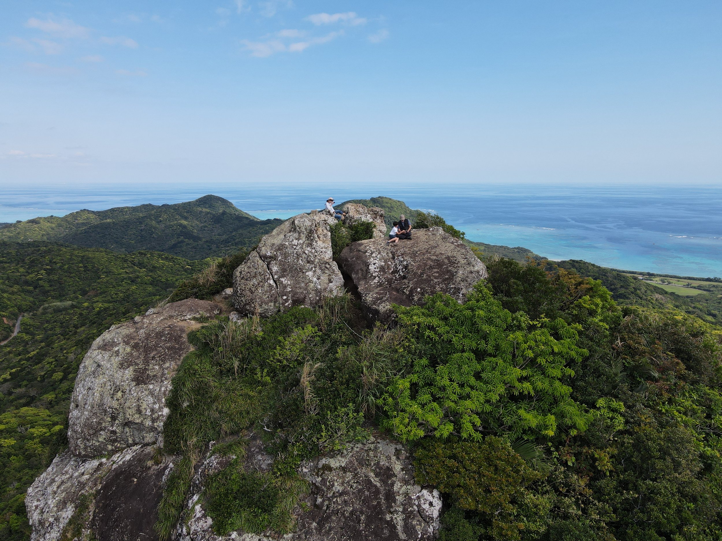
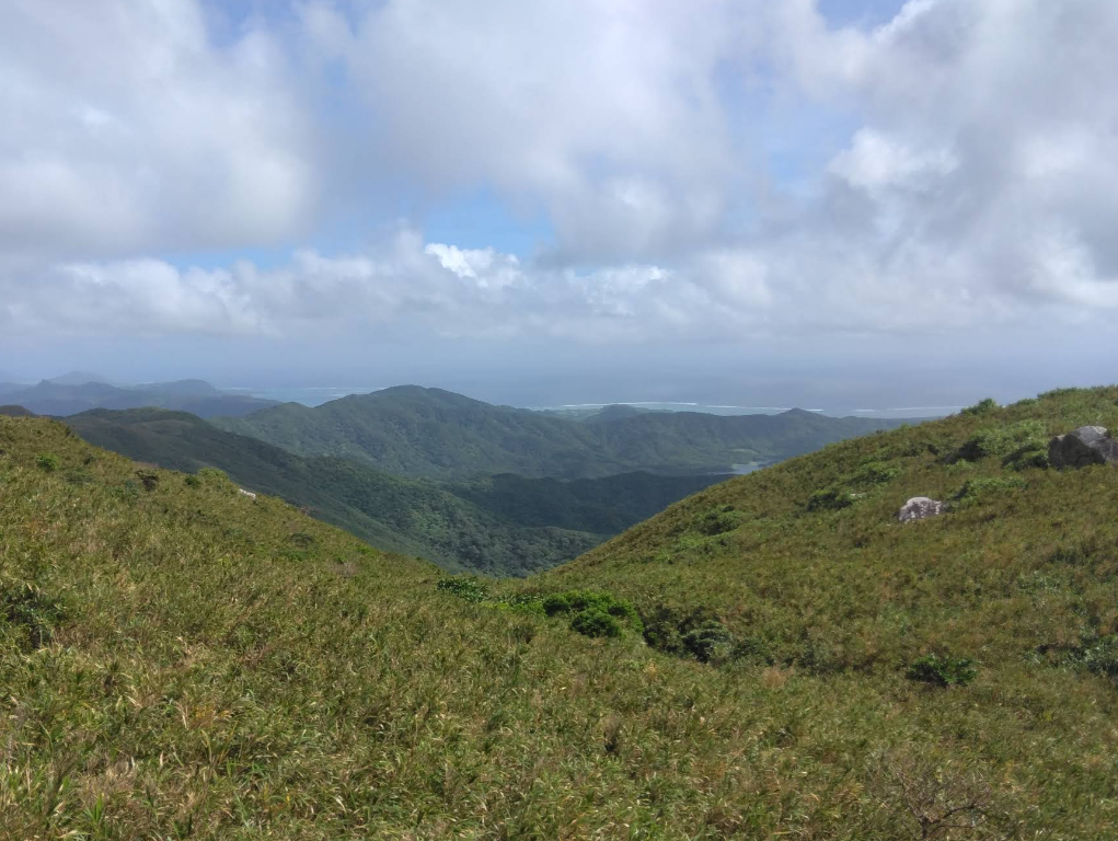
Nosoko Mape
The site
Nosoko Mape is a sacred mountain for the local community, and several legends are linked to it. Today, it has become a relatively popular hike. It is easy to access, and the climb from the midway point is suitable even for children. The 360° view from the summit, overlooking the entire northern area of Ishigaki, is truly spectacular.
Duration
From the midway point: 30–45 minutes.
From the base entrance: about 3 hours round trip.
How to get there
Midway point (shortcut): on Google Maps (parking area near the trail entrance).
Base entrance: on Google Maps. There is no official parking area, but very few people start from here, so you will usually find space to park. Note that this entrance may be closed after typhoons if maintenance is required.
Equipment
No river or water sections on this hike, so regular light hiking clothes are fine. Avoid flip-flops, as you will be climbing through the jungle.
Safety & Tips
This is considered one of the safest treks, and it is usually frequented by other hikers, so you are unlikely to be alone. Phone signal is available throughout the entire climb. The trail becomes very slippery after rain, and the summit can be windy—please be careful.
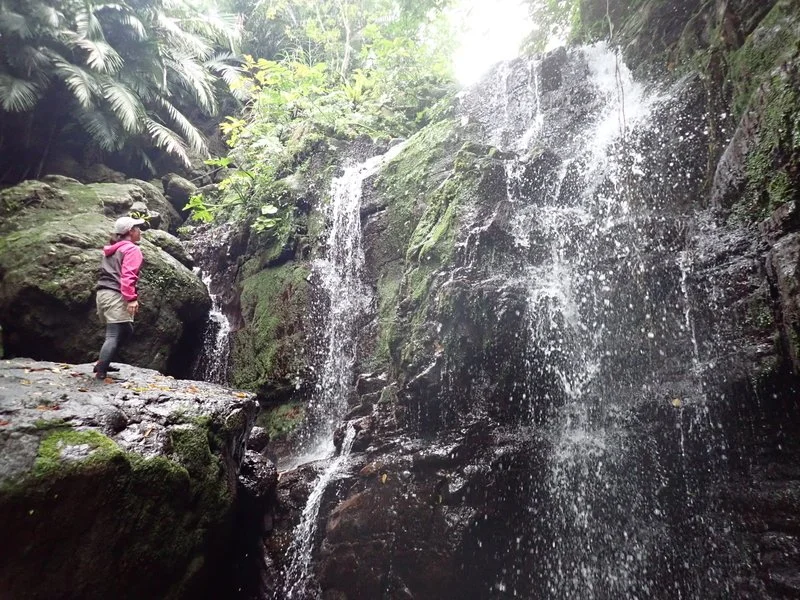
Nosoko’s Secret Waterfall
This waterfall is a popular choice for local guides when they want to include a jungle activity suitable for small children or guests who prefer something easy. It’s a very enjoyable experience with very little effort.
Located just two minutes by car from Sky Ocean, it feels like a miniature version of the Arakawa waterfall river trek. The walk to the falls takes only 5 to 10 minutes. The rocks can be a bit slippery, but the trail is manageable with regular water shoes. You can also rent our river trekking shoes at the front desk.
This is a secret spot, so we cannot publish the details here. However, we have a WhatsApp message prepared with the exact location and instructions. Just ask us at check-in, and we’ll be happy to guide you there!
Mount Omoto Hike
The site
Mount Omoto is the highest peak in the entire Okinawa prefecture, even though it rises only to 525 meters. The trail is pleasant up to the waterfall, after which it becomes steeper, but the more difficult sections have been fitted with steps. It is strongly advised not to attempt this hike on rainy days, as the path quickly turns into a mudslide.
The waterfall is located about one-third of the way up. This first section is the easiest and the most enjoyable. Just before reaching the waterfall, you can also catch a partial view of the island from a small clearing. If you start feeling tired, overheated, or find the trail more challenging than expected, this is a very good place to turn back.
From the summit, walk past the large communication tower and take the path to the left. If maintenance has been recently performed, the viewpoint offers a beautiful panorama. If not… the view may be a little underwhelming.
Duration: approximately 3 to 4 hours round trip.
How to get there: On Google Maps (parking area near the trail entrance).
Equipment
No river or water sections on this hike, so regular light hiking clothes are fine. You’ll need plenty of water, good shoes, and we recommend wearing a long pants.
Safety & Tips
This is considered one of the safest treks, and it is usually frequented by other hikers, so you are unlikely to be alone. Phone signal is available throughout the entire climb.